- English
- Português
Languages:
This site is created using Wikimapia data. Wikimapia is an open-content collaborative map project contributed by volunteers around the world. It contains information about 32910245 places and counting.
Learn more about Wikimapia and cityguides.
Guararapes
Guararapes is a Brazilian city of São Paulo. It is located at latitude 21°15'39 "South and longitude 50°38'34" West, with an altitude of 415 meters. Its population in 2008 was 29,589 inhabitants. It has an area of 956.5 km².
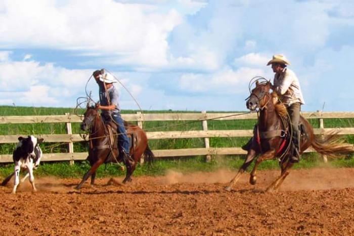
The City of Guararapes, is formed by residents of different origins and nationalities: Italian, Portuguese, Lebanese, Swiss, French, Spanish, African, German and Japanese. Today all perfectly assimilated and integrated into the life and customs. Guararapes today has a population of over 30,000 inhabitants with a density of 28.59 inhabitants per square kilometer. It is a city that emerged spontaneously, but their pre-established route, forced the occupants to make constructions obeying the rules of that route. The dash has the urban form of a chessboard, with straight streets and square blocks.
The story of Guararapes, began in 1908 when the brothers Pinto de Oliveira (Antonio Joaquim and Prisciliano), from Minas Gerais, more precisely from Varginha, bought lands between the streams and Alligator fruity and were living there. The arrival of some families came in 1920, after construction of the road Aguapeí-Tietê by Manoel Bento da Cruz.
In 1927, the brothers Pinto de Oliveira, decided to subdivide their property, handing the task to the Company of Colonization Ltda. Vested with full powers to achieve the goal, that company could, through contracts signed with buyers liberal, is rapidly discharging the mission entrusted to it and thus contribute to progress, as evidenced by the construction of the road the Aguapeí.
In 1928 he was made a donation towards the formation of the patrimony. That same year, with the advancement of the railroad northwest of Brazil, was designed to build a station on land the brothers Pinto de Oliveira, a little beyond the stream Frutal. Entrusted to the engineer Mário Barroso Ramos, the design of roads and subdivision, and on December 8, 1928 date chosen for the official founding of the city, with the Patron Saint, Our Lady of Immaculate Conception. As part of the ceremonies, it would conclude, on schedule, open air mass in front of the cruise ship, built for that purpose. Torrential rains however prevented the realization of the religious act and gave rise to the festivities scheduled to take place in Araçatuba. Due to the abundance of jaboticabas in the region, called themselves "Frutal" to Heritage.
On December 8, 1929, at which commemorated the first anniversary of the founding of the town, Monsignor Adauto Richards, vicar of the Parish of Araçatuba open air mass celebrated and blessed the launch of the first bricks of the chapel built by Louis Ferreira.
The following year, was inaugurated the train station. At the elevation of the property to the rank of District Peace in the city and county of Araçatuba, through Decree-State Law No. 6546 of 10 July 1934, the then Department of Municipalities has seen fit to rename the city to Guararapes, in tribute to the important fact of our history, the Battle of Guararapes. The District is elevated to a municipality, through the State Law No. 2833 of 5 January 1937 by freeing himself politically, Araçatuba.
Census Data – 2000
Total population: 28,843
* Urban: 26,130
* Rural: 2713
* Men: 14 308
* Women: 14 535
Population density (inhabitants / km²): 30.15
Infant mortality to 1 (per thousand): 10.20
Life expectancy (years): 74.58
Fertility rate (children per woman): 1.79
Literacy: 90.60%
Human Development Index (HDI-M): 0.802
* HDI-M Income: 0.711
* HDI-M Longevity: 0.826
* HDI-M Education: 0.870
(Source: IPEADATA)
Guararapes is a Brazilian city of São Paulo. It is located at latitude 21°15'39 "South and longitude 50°38'34" West, with an altitude of 415 meters. Its population in 2008 was 29,589 inhabitants. It has an area of 956.5 km².
The City of Guararapes, is formed by residents of different origins and nationalities: Italian, Portuguese, Lebanese, Swiss, French, Spanish, African, German and Japanese. Today all perfectly assimilated and integrated into the life and customs. Guararapes today has a population of over 30,000 inhabitants with a density of 28.59 inhabitants per square kilometer. It is a city that emerged spontaneously, but their pre-established route, forced the occupants to make...
 Reduce description
Guararapes on the map.